You’ve just found the perfect Georgian townhouse in London, or maybe you’re an architect staring at a set of hand-drawn plans from 1987 that bear almost no resemblance to the building standing in front of you. Either way, someone has just told You’ll need a measured building survey before we can go any further. And you’re left wondering what that actually means, what it costs, and whether it’s really necessary.
You’re not alone. It’s one of the most misunderstood terms in UK property and construction, often confused with a condition survey, a topographical survey, or even a basic building survey. Yet a measured building survey is the single document that everything else in your project depends on. Get it wrong, or skip it altogether, and architects, planners, and contractors end up working from guesswork. That’s how budgets balloon and planning applications get rejected.
We’ve walked hundreds of clients through this process, from homeowners extending a Victorian terrace to developers converting listed heritage buildings, and this guide breaks down exactly what a measured building survey is, how it works, and what you genuinely need to know before booking one.
Planning work in the capital? See what measured building surveys in London involve and how to choose measured building surveyors.
What Is a Measured Building Survey?
A measured building survey is a precise, dimensionally accurate record of a building’s existing form its walls, floors, ceilings, roof lines, doors, windows, and structural features captured and translated into scaled drawings or 3D models. In plain terms, it’s a detailed “as-builtpicture of a property exactly as it stands today, not as it was originally designed or as someone remembers it being built.
If you’ve ever asked “what is a survey measurement in a construction context, this is your answer: it’s the process (and the resulting data) of measuring a structure’s physical geometry with enough accuracy that architects and engineers can design against it with confidence. The measured survey, at its core, is simple: it removes assumptions from the design process.
This differs fundamentally from a building survey in the RICS sense, which assesses the condition, defects, and structural health of a property. A measured survey doesn’t tell you if the roof is leaking or the foundations are subsiding; it tells you precisely how big everything is and where it sits in space. Understanding the difference between a measured survey and building survey early on saves confusion (and money) later.
How Do They Measure Buildings? The Tools Behind the Process
Gone are the days of tape measures and graph paper (mostly). Modern measured building surveys rely on a blend of technology and trained surveying judgement:
- Total stations for precise angular and distance measurements
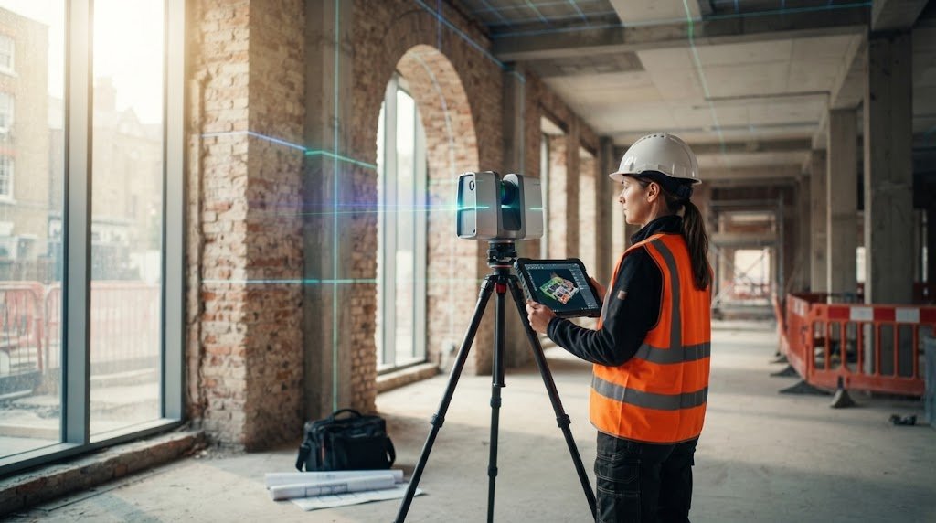
- 3D laser scanning (point cloud scanning) to capture millions of data points across a building’s surfaces in minutes
- Photogrammetry, using overlapping photographs to reconstruct 3D geometry
- Traditional hand measurement for tight spaces, awkward junctions, or verification checks
For anyone wondering how they measure buildings on a genuinely complex site a Victorian church, a multi-storey commercial block, or a listed façade laser scanning has become the industry standard. A scanner sits on a tripod, rotates through 360 degrees, and captures a dense “point cloudof the entire space with millimetre-level accuracy. Multiple scans are then stitched together to build a complete digital replica of the building.
What Does a Measured Building Survey Include?
A common question we hear is what a measured building survey includes, and the honest answer is: it depends on the brief, but a thorough survey typically covers:
- Floor plans for every level, showing accurate room dimensions and wall thicknesses
- Elevations (external faces of the building) drawn to scale
- Cross-sections showing floor-to-ceiling heights and structural relationships
- Roof plans, including pitch and ridge lines
- Locations of doors, windows, staircases, and structural columns
- Levels and datums, tying the building into Ordnance Survey or site-specific benchmarks
A genuinely useful measured building survey example would be a three-storey period conversion where the surveyor delivers a full set of CAD floor plans, four elevations, two sections, and a roof plan all cross-referenced to a single set of coordinates so nothing drifts out of alignment when the architect starts designing an extension.
How Does a Measured Building Survey Work? The Process Explained
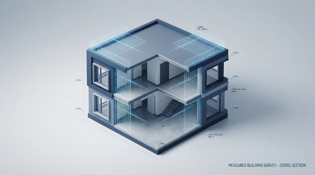
Understanding the measured building survey process explained step by step helps demystify what’s actually happening on-site:
- Site assessment and scoping: the surveyor reviews the brief, access constraints, and required level of detail.
- Data capture: using scanning, a total station, or photogrammetry (often a combination), the surveyor records every relevant surface and feature.
- Point cloud registration: scan data from multiple positions is merged into a single, accurate 3D dataset.
- CAD or BIM modelling: converts the raw data into usable drawings.
- Quality checks: dimensions are cross-verified against on-site spot checks to catch errors before drawings are issued.
- Delivery: final drawings or models are handed over in the client’s required format.
This is genuinely a case where experience matters more than equipment. Two surveyors with identical laser scanners can produce very different quality outputs depending on how carefully they register scans and interpret ambiguous junctions. A rotten timber beam hidden behind plaster, for instance, needs a trained eye, not just a sensor. Our guide to choosing a measured building surveyor lists five checks to run before you book.
CAD, BIM, and Revit: What Are You Actually Getting?
Most clients today don’t just want a PDF of lines on paper; they want data they can build on. This is where measured building survey CAD drawings deliverables and measured building survey Revit workflow come into play.
- CAD drawings remain the industry standard for straightforward 2D floor plans, elevations, and sections, ideal for planning applications and smaller residential projects.
- Revit / BIM models go a step further, turning the survey into an intelligent 3D model where walls, floors, and objects carry data (materials, dimensions, even structural properties). This is increasingly requested on larger commercial or heritage projects where multiple consultants need to work from the same coordinated model.
If you’ve heard the term measured building surveys BIM models explained and felt unsure whether you need one, as a rule of thumb, if more than two design disciplines (architect, structural engineer, M&E consultant) will be working on the same building, a BIM-ready model usually pays for itself in reduced clashes and redesigns down the line.
Measured Survey vs Topographical Survey: Not the Same Thing
It’s worth clarifying measured building survey vs topographical survey, because the two are frequently confused. A measured survey focuses on the building itself, its internal and external geometry. A topographical survey maps the land, boundaries, levels, drainage, and existing features of a site, typically before a building even exists or as context around it. Many larger developments require both, run together for efficiency.
If you are not sure which survey your project needs, our land surveyor guide matches common situations to the right type of survey.
Why Do You Need a Measured Building Survey?
So, why do you need a measured building survey in the first place? A few common triggers:
- Planning permission: Most local planning authorities require accurate existing floor plans and elevations before approving alterations or extensions, making a measured building survey for planning permission one of the most frequent reasons clients book one.
- Listed buildings and heritage properties: A measured building survey for listed buildings or a measured building survey for heritage properties is often a prerequisite for listed building consent, since accurate records protect historic fabric during any intervention.
- Renovation and extension design architects can’t design reliably from outdated plans or guesswork.
- Asset management and facilities planning: landlords and estate managers use measured surveys to maintain accurate records across large portfolios.
If you’re asking who needs a measured building survey, the honest answer is: almost anyone altering, extending, restoring, or formally documenting an existing structure, from a single homeowner to a national heritage trust.
How Long Does a Measured Building Survey Take?
Timescales depend heavily on scope. A modest residential property can often be surveyed on-site in half a day to a full day, with drawings delivered within one to two weeks. Larger or more complex buildings, particularly those requiring extensive point cloud scanning and detailed CAD or BIM output, can take several days on-site and several weeks for full drawing production.
Choosing RICS Regulated Measured Building Surveyors
Not all surveying outfits offer the same rigour. Working with RICS-regulated measured building surveyors gives you a level of professional accountability, quality assurance, and insurance protection that unregulated providers simply can’t match. For anyone comparing measured building survey companies in Liverpool or further afield, checking RICS regulation status is a sensible first filter.
If you’re weighing up your options, our earlier guides 5 Tips for a Stress-Free Measured Survey and what precision protects you against as a homeowner or developer go into more detail on picking the right partner and avoiding common pitfalls. For London-specific projects, our piece on what every homeowner should know about a measured survey is also worth a read before you commission one.
FAQ’S
What is a measured building survey?
A measured building survey is a precise, scaled record of an existing building’s dimensions and layout, typically presented as CAD drawings or a 3D BIM model, used by architects, engineers, and planners to design accurately against the real structure rather than outdated or assumed plans.
What is a survey measure?
A survey measure refers to the process and techniques used to record a building’s physical dimensions using tools like laser scanners, total stations, or photogrammetry to produce accurate, scaled measurements of its geometry.
How much should a measured survey cost?
Costs vary by building size, complexity, and level of detail required. Small residential surveys can start in the low hundreds of pounds, while larger commercial or heritage properties needing full 3D scanning and BIM modelling can cost several thousand. Always ask for an itemised quote based on square metreage and deliverables.
How do they measure buildings?
Surveyors use a combination of 3D laser scanning, total stations, photogrammetry, and hand measurement to capture a building’s geometry, then process that data into scaled CAD drawings or BIM models with millimetre-level accuracy.
Final Thoughts
A measured building survey provides an accurate foundation for planning, design, and property decisions. Whether you’re extending, renovating, or applying for planning permission, reliable survey data can help prevent costly mistakes and delays. Choosing an experienced, RICS-regulated surveyor ensures you get accurate information suited to your project’s needs, helping protect your investment from unexpected costs later.