A measured building surveyor turns a building into accurate drawings. Floor plans, elevations, sections, a 3D point cloud or a full BIM model, all taken from the building as it actually stands rather than from drawings made when it was built. Architects design from that data, engineers calculate from it, lease plans and planning applications are based on it, and a refurbishment that starts from bad measurements ends with steel that does not fit and walls that are not where the drawing says they are.
This guide explains what a measured building surveyor does, the equipment and standards they work to, what the deliverables look like, what a survey costs in 2026 and the five checks to run before you book one. It is written for architects, developers, landlords and homeowners in Liverpool, Merseyside and the North West, and it applies just as well to a terraced house loft conversion as to a city centre office.
In this guide
- What a measured building surveyor does
- When you need one
- Equipment and methods
- What happens on survey day
- The RICS measured survey standard
- What you receive
- Five checks before you book
- How to brief a measured building surveyor
- Costs in 2026
- Red flags
- Measured building surveyors in Liverpool
- FAQs
What a Measured Building Surveyor Does
A measured building surveyor captures the geometry of a building and converts it into drawings and data that other professionals can rely on. The job has three parts. On site, the surveyor sets up a control network, usually a handful of fixed reference points, and captures every wall, opening, level, step and ceiling height with a laser scanner, a total station and a laser distance meter. In the office, the raw data is processed, checked against the control and drawn up in CAD or modelled in BIM software. Finally the drawings are issued with a note on the accuracy achieved and anything that could not be measured.That is different from a building surveyor who inspects the condition of a property, and different again from a land surveyor who maps the ground around it. Our guide to what a land surveyor does explains that split. Many practices, including ASG Consulting, offer both, which matters when a project needs the building and its site on one coordinated set of drawings.If you want the background on the survey itself before reading about the surveyor, our explainer on what a measured building survey is covers the basics.
When You Need One
- Before an architect starts design work on an extension, conversion or refurbishment
- For a planning application, where existing and proposed drawings must be accurate
- For structural calculations, where span and bearing dimensions have to be right
- For lease plans and Land Registry compliant plans
- For floor area measurement under IPMS or the RICS property measurement standard, which drives rent and value
- For a dilapidations or schedule of condition record where the layout matters
- For heritage recording, insurance reinstatement and facilities management
- For a BIM model of an existing building before it is fitted out or sold
In every case the point is the same. A measured building surveyor gives everyone downstream the same accurate starting point.
Equipment and Methods
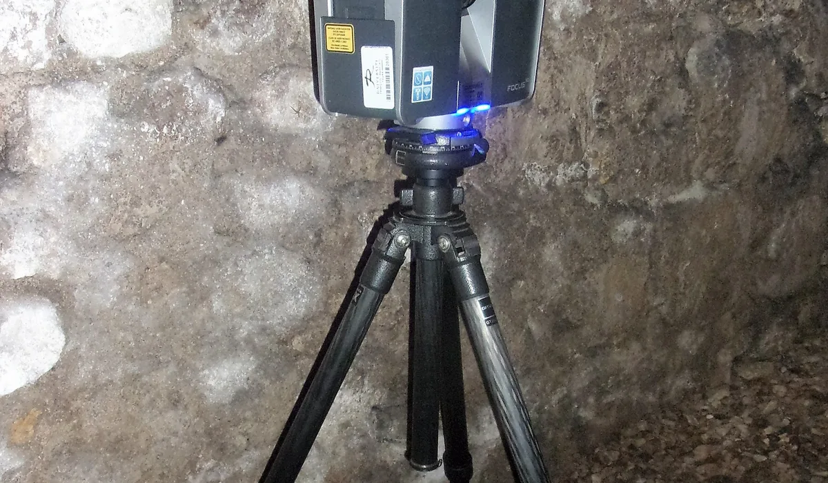
Terrestrial laser scanner. The core tool of a modern measured building surveyor. The scanner sits on a tripod and captures millions of measured points in every direction, producing a point cloud of the whole space in a few minutes per set up. Internal dimensions are typically good to a few millimetres. Scanning is fast on site, captures everything in view including the detail nobody thought to ask for, and gives a record you can return to without a second visit.
Total station. A precision instrument that measures angles and distances to a reflector or directly to a surface. It establishes the survey control that ties every scan and every measurement into one coordinate system, and it is still the most accurate way to measure elevations and to link a building to the site and to Ordnance Survey grid.
Laser distance meter and tape. For checks, for small spaces and for the details a scanner cannot see, such as the inside of a cupboard or behind a radiator.
Drone. For roofs, chimneys and high elevations where access is difficult. Our guide to surveying drones covers what they can and cannot capture.
Mobile and handheld scanners. Walk through devices that capture quickly at slightly lower accuracy. Useful for large plain buildings and for facilities management, less suitable where millimetre accuracy is needed.
The method is chosen to suit the accuracy band and the deliverables, not the other way round. A good measured building surveyor will tell you which tools they will use and why.
What Happens on Survey Day
A measured building surveyor arrives with the scanner, the total station, targets and a laptop, and the first hour is spent setting out control. Targets or reference spheres are placed where several scans can see them, and the total station fixes their positions so that every scan can be tied to one grid. The surveyor then works through the building room by room, moving the scanner every few metres so that no wall is hidden, and photographing as they go. Cupboards are opened, ceiling hatches are lifted where it is safe, and levels are taken at thresholds and stair landings. On a house this takes a few hours. On a large office it can take days, often outside working hours so that tenants are not disturbed. Before leaving, a good measured building surveyor checks the scans overlap and that nothing has been missed, because a return visit is the most expensive mistake in the job.
The RICS Measured Survey Standard
The reference document for measured building surveyors in the UK is Measured surveys of land, buildings and utilities, published by RICS and now in its 3rd edition. It was produced by the RICS geomatics working group and endorsed by the survey associations, and it replaced the old scale based specification with a system of survey accuracy bands.
The accuracy band is the single most important thing to agree before a survey starts. Each band sets a tolerance for how closely a point on the drawing must match the real building. A tight band costs more because it needs more control, more scans and more checking. A looser band is fine for a feasibility study or a space planning exercise. The standard also sets out what detail is captured at each level, how control is established and recorded, what the deliverables should contain and what metadata accompanies the data. A surveyor who quotes to the standard will name the band on the quote and again on the drawings.
Floor areas are a separate matter. Where the purpose is area measurement for rent, valuation or sale, the surveyor should also work to the RICS property measurement standard, which incorporates the International Property Measurement Standards. Ask for the basis of measurement to be stated on the plan.
What You Receive
| Deliverable | Typical format | Who uses it |
|---|---|---|
| Floor plans with room names, openings, levels and ceiling heights | DWG or DXF plus PDF | Architects, agents, planners |
| Elevations showing openings, string courses, roof lines and levels | DWG and PDF | Architects, planners, conservation officers |
| Sections through the building at agreed positions | DWG and PDF | Architects, structural engineers |
| Reflected ceiling plans and roof plans | DWG and PDF | Services engineers, fit out teams |
| Registered point cloud | E57, RCP or LAS | Design teams working in 3D |
| 3D BIM model at an agreed level of detail | Revit, IFC | Developers, facilities managers, design teams |
| Area schedules to IPMS or the RICS standard | Spreadsheet and plan | Agents, valuers, landlords |
| Survey report with control, accuracy achieved and exclusions | Everyone who relies on the data |
The survey report is the item most often missed off a cheap quote. Without it nobody can tell what accuracy was achieved, which rooms were locked, which voids were not entered and what datum the levels refer to.
Five Checks Before You Book
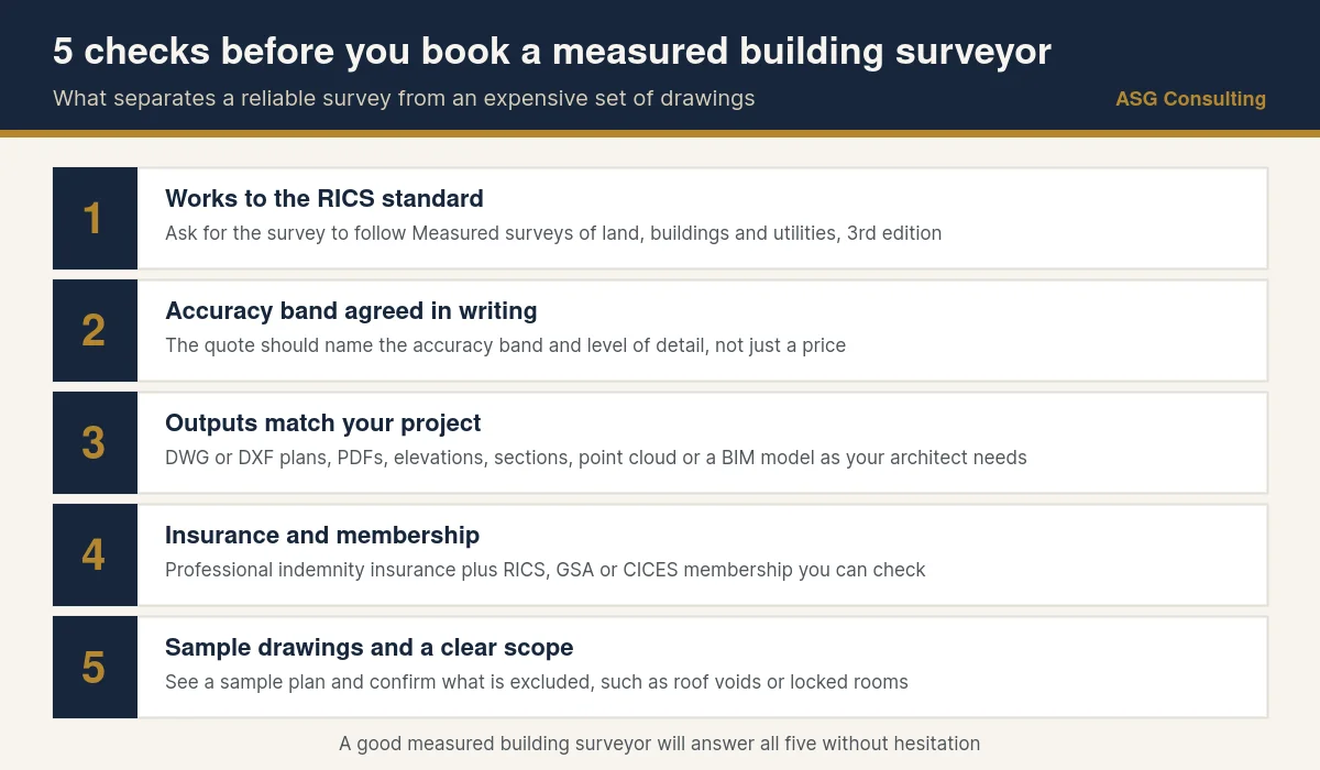
- They work to the RICS standard. Ask whether the survey will follow Measured surveys of land, buildings and utilities, 3rd edition. If the answer is vague, move on.
- The accuracy band and detail level are in writing. A quote that gives a price with no band is a quote for an unknown product. The band should match what your architect or engineer needs.
- The outputs match your project. Confirm the file formats, the drawing scale, the sections required and whether a point cloud or BIM model is included. Ask your architect what they need before you ask the surveyor.
- Insurance and membership you can check. Professional indemnity insurance is essential. Look for membership of RICS, the Geospatial Survey Association, formerly The Survey Association, or the Chartered Institution of Civil Engineering Surveyors.
- Sample drawings and a clear scope. Ask for a sample plan from a similar building and read the exclusions. Roof voids, locked rooms, external areas and neighbouring land are the usual gaps.
How to Brief a Measured Building Surveyor
The quality of a measured survey depends as much on the brief as on the surveyor. The standard puts the conversation between client and surveyor at the centre of the process, and a good brief covers the following.
- What the survey is for, because a planning application, a structural design and a BIM fit out need different things
- The extent, meaning which floors, which rooms, the roof, the external envelope and any outbuildings
- The accuracy band and the level of detail
- The deliverables and formats, and whose CAD layer standard to use
- The datum and grid, for example Ordnance Survey grid and datum or a local site grid
- Access arrangements, keys, tenants, ceiling voids and any health and safety issues
- Timescale for the site visit and for delivery
If you are not sure what to ask for, say so. Any competent measured building surveyor will ask the right questions and propose a specification. Be wary of one who simply sends a price.
Measured Building Surveyor Costs in 2026
Fees depend on the size and complexity of the building, the accuracy band, the deliverables and access. Published 2026 price lists from UK survey firms give the following broad picture. Treat them as a starting point, not a quote.
| Project | Typical 2026 fee |
|---|---|
| Three bed house, plans and elevations | 800 to 2,500 pounds |
| Per floor of a typical commercial building | 350 to 3,000 pounds |
| Per square metre for larger standard buildings | 2 to 3.50 pounds |
| Laser scanning day rate including processing | 800 to 2,500 pounds |
| Large or complex commercial site with BIM | 5,000 to 50,000 pounds or more |
What pushes a fee up is ornate or irregular geometry, high ceilings, many small rooms, poor access, a tight accuracy band, a BIM deliverable and a fast turnaround. What brings it down is a clear brief, existing drawings to work from, a building that is empty and unlocked, and bundling the building survey with a topographical survey of the site on the same visit. Measured building surveyors in the North West generally sit below London rates.
The cheapest quote is rarely the best value. A survey that misses a 40mm step in a floor level costs nothing to fix on the drawing and thousands to fix on site.
Red Flags
- No accuracy band or standard named on the quote
- No survey control, with every room measured independently and stitched together by eye
- Drawings issued with no report, no datum and no note of what was not surveyed
- Elevations drawn from photographs alone rather than measured
- No professional indemnity insurance or an unwillingness to show the certificate
- A price given without asking what the survey is for
Measured Building Surveyors in Liverpool
Liverpool keeps measured building surveyors busy. The city has one of the largest stocks of listed buildings outside London, a wave of warehouse and office conversions from the Baltic Triangle to the Ten Streets, and a steady run of Victorian terrace extensions and loft conversions across Merseyside. Each of those needs accurate existing drawings before anything else can happen, and heritage work in particular needs the detail that only a laser scan captures.
ASG Consulting carries out measured building surveys from our office in Liverpool city centre. We scan and draw to the RICS standard, agree the accuracy band and deliverables in writing before we start, and because our building surveyors and structural engineers sit in the same office, the drawings are produced with the next stage of the project in mind. Our measured building survey page sets out the service, and for projects in the capital our measured building surveys London page explains how we work there.
Measured Building Surveyor FAQs
What is the difference between a measured building surveyor and a building surveyor?
A measured building surveyor records the geometry of a building and produces accurate drawings and models. A building surveyor inspects the condition of a building and reports on defects. The two often work together, but they are different disciplines with different equipment and different outputs.
How accurate is a measured building survey?
It depends on the accuracy band agreed before the survey. Laser scanning typically achieves a few millimetres for internal dimensions and slightly more for elevations where access is harder. The RICS standard sets out the bands, and a good surveyor states the band on the quote and the drawings.
How long does a measured building survey take?
A typical house takes half a day to a day on site and about a week for drawings. A multi storey commercial building can take several days on site and two to four weeks for a full drawing package or BIM model. Laser scanning shortens the site time but the office processing still takes time.
Do I need a measured building survey for a planning application?
Most planning authorities require accurate existing and proposed drawings, and architects will not design from guesswork. For anything beyond a very simple project a measured survey is the safe foundation, and for listed buildings it is close to essential.
Can a measured building surveyor measure floor areas for a lease or valuation?
Yes. Ask for the areas to be measured to the RICS property measurement standard and the International Property Measurement Standards, and for the basis of measurement to be stated on the plan. This is a separate task from the geometric survey and should be in the brief.
What qualifications should a measured building surveyor have?
Look for membership of RICS in the geomatics pathway, the Geospatial Survey Association or the Chartered Institution of Civil Engineering Surveyors, plus professional indemnity insurance. Ask what standard they survey to and for sample drawings from a comparable building.
Book a Measured Building Survey in Liverpool
ASG Consulting is regulated by RICS. Our measured building surveyors scan and draw homes, commercial buildings and heritage properties across Liverpool, Merseyside and the North West, working to the RICS measured survey standard with the accuracy band and deliverables agreed in writing. To discuss your project, visit our measured building survey page.
About the Author
Harry is a property content writer with 3 years of experience writing about building surveying, commercial property and property compliance in the UK. He writes the guides at ASG Consulting for buyers, tenants and landlords, turning survey practice into clear, practical advice.
Reviewed by Dave MacMillan MRICS, chartered surveyor at ASG Consulting. Dave checks the technical content of our guides against current RICS practice before they are published.
Featured photo of a 3D laser scanner at work inside a building by Joël Thibault via Wikimedia Commons, licence CC BY SA 4.0, cropped.