Surveying drones have changed how surveyors look at roofs, facades, sites and land. A drone for surveying can capture a whole roof in minutes, map a development site to centimetre accuracy or reveal heat loss across a building, all without scaffolding, cherry pickers or anyone working at height. For property owners, that means faster answers and money spent on repairs rather than access.
This guide explains how surveying drones work, which sensors they carry, how accurate they are, the best uses in building surveying, the UK rules that changed on 1 January 2026, where drones fall short and what to ask before you hire a drone survey. It is written for homeowners, landlords, facilities managers, developers and heritage owners across Liverpool, Merseyside and the North West.
In this guide
- What surveying drones are
- How a drone survey works
- Sensors and what they capture
- Types of drone for surveying
- How accurate are surveying drones
- Seven best uses in building surveying
- What you receive
- Drones compared with traditional access
- Heritage buildings in Liverpool
- UK drone rules in 2026
- Where drones fall short
- Privacy and data
- Cost
- Hiring a drone survey
- FAQs
What Are Surveying Drones?
Surveying drones are unmanned aircraft fitted with cameras or sensors that collect measured, location tagged data about land and buildings. Unlike a hobby drone taking holiday footage, a drone for surveying is flown on a planned route, records precise position data for every image or laser pulse, and produces outputs a surveyor can measure from, such as maps, 3D models, point clouds and thermal images.
The drone is only part of the job. The real value comes from the surveyor who plans the flight, checks the data and interprets what it shows. A roof photo is useful. A RICS regulated surveyor explaining which slates have slipped, why the valley gutter is leaking and what the repair will involve is far more useful.
How a Drone Survey Works
Most surveys with surveying drones follow the same five stages.
- Brief and site review. The surveyor agrees what you need, such as a roof condition report, a topographic plan or a thermal survey, and checks the site for airspace limits, obstacles and people.
- Flight planning. Software sets the flight path, height, speed and overlap between images. For mapping, each photo typically overlaps the next by a large margin so software can stitch them together accurately.
- Control and positioning. The drone uses satellite positioning, often with RTK correction, to tag each image with an accurate location. Ground control points or check points may be set out to confirm accuracy.
- Flight and capture. The drone flies the planned route automatically, while the pilot monitors safety and takes extra close up images of areas of concern.
- Processing and reporting. The images or laser data are processed into the agreed outputs, then reviewed by the surveyor and written up in a report.
Surveying Drone Sensors and What They Capture
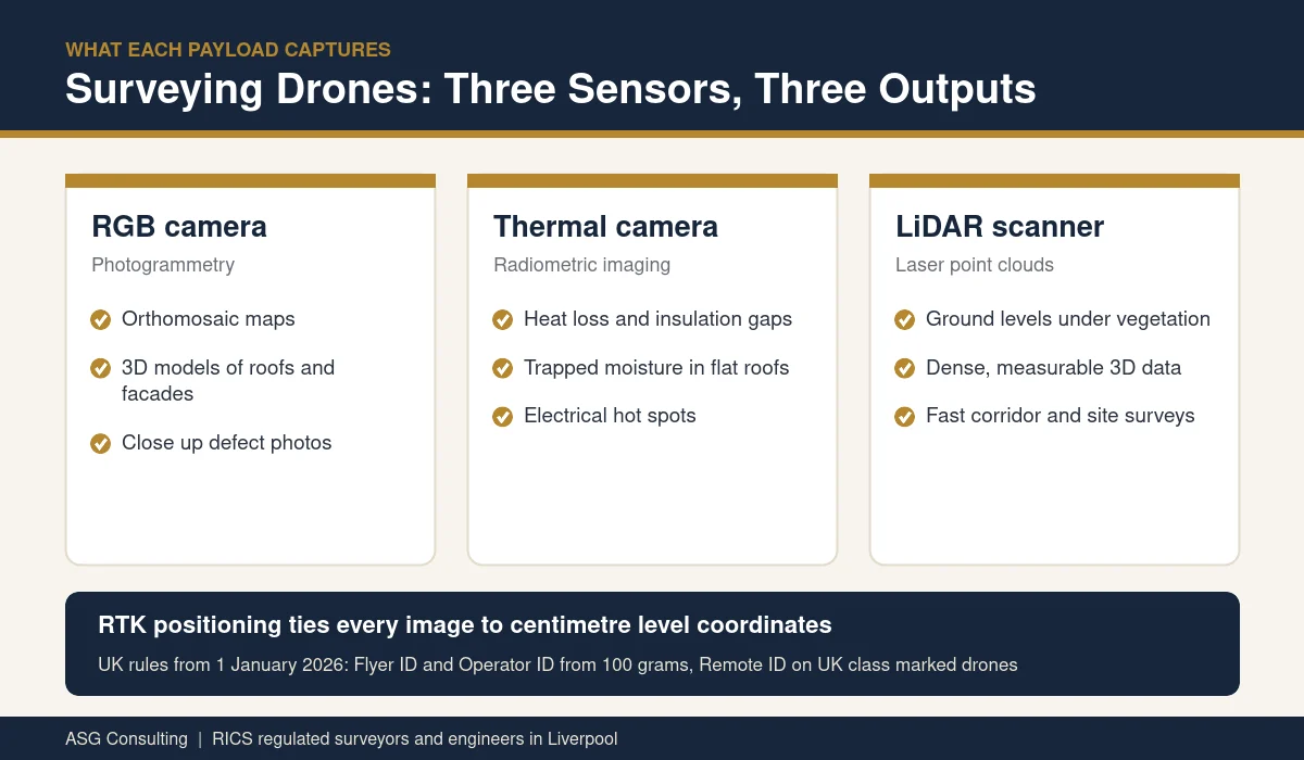
The sensor a drone carries decides what it can tell you. These are the main payloads used by surveying drones today.
RGB cameras for photogrammetry
A high resolution camera takes hundreds of overlapping photos. Photogrammetry software matches points across the images to build orthomosaic maps, 3D models and elevation surfaces. This is the most common setup and suits roofs, facades, construction progress and open sites.
Thermal cameras
A thermal camera records surface temperature. On buildings it can reveal heat loss, missing insulation, trapped moisture under flat roof coverings and electrical hot spots. Thermal surveys work best on cold, dry and still days, often early in the morning.
LiDAR scanners
LiDAR fires laser pulses and measures their return to build a dense 3D point cloud. Unlike photogrammetry, some pulses pass through gaps in trees and hedges, so LiDAR can map the ground under vegetation. It suits topographic surveys of overgrown land, corridors and complex structures.
Zoom cameras
A powerful zoom lets the pilot inspect chimneys, stonework, flashings and fixings from a safe distance, which is useful on tall buildings and busy streets.
Types of Drone for Surveying
There are two main families of surveying drones.
- Multirotor drones. Four or more rotors let the drone hover, fly slowly and get close to a building. They are ideal for roofs, facades and smaller sites. Enterprise models on the market in 2026 include compact mapping drones with built in RTK, such as the DJI Matrice 4E, and larger platforms such as the DJI Matrice 400 that can carry LiDAR sensors like the Zenmuse L3.
- Fixed wing and vertical take off drones. These fly like small aircraft and cover large areas efficiently, which suits farmland, quarries and long corridors. They are rarely needed for a single building.
For most building surveys in towns and cities, a multirotor drone for surveying with a good camera, a thermal option and RTK positioning covers the job.
How Accurate Are Surveying Drones?
Accuracy depends on the sensor, the flight height, the positioning method and how the data is checked. With RTK correction, drone positioning is typically quoted at around one centimetre plus one part per million of distance horizontally. Manufacturers and sellers quote LiDAR point clouds from a sensor such as the Zenmuse L3 at around 3 centimetres vertically and 4 centimetres horizontally when flown at 120 metres.
In practice, a professional survey confirms accuracy with independent check points on the ground and states the achieved accuracy in the report. If your project needs millimetre precision, such as setting out a structural steel frame, a ground based total station or laser scanner is still the right tool. Our guide to choosing a land surveyor explains when each method fits.
Seven Best Uses for Surveying Drones in Building Surveying
- Roof inspections. Slipped slates, cracked tiles, failed flashings, blocked gutters and ponding on flat roofs, captured without ladders or scaffolding. See our guide to a drone roof inspection.
- Facade and high level condition surveys. Stonework, render, pointing, cladding fixings and window heads on tall or busy elevations.
- Measured surveys and elevations. Accurate drawings of elevations and roof plans from 3D models, often combined with a measured building survey on the ground.
- Topographic and site surveys. Levels, contours and features for planning, design and drainage.
- Thermal surveys. Heat loss and moisture mapping across roofs and walls.
- Construction progress monitoring. Regular flights that show developers, funders and employers agents how work is progressing.
- Storm and insurance damage. Fast evidence after high winds or impact damage, before anyone climbs onto a damaged roof.
What You Receive From Surveying Drones
The outputs from surveying drones should match the decision you need to make. Agree them at the start, because they change how the flight is planned.
| Output | What it is | Typical use |
|---|---|---|
| Annotated photographs | Close up images with defects marked and explained | Roof and facade condition reports |
| Video | A recorded flight around the building | Briefing contractors, insurers and owners |
| Orthomosaic | A single scaled map stitched from many images | Roof plans, site layouts and progress records |
| 3D model | A textured model of the building or site | Measuring heights, areas and elevations |
| Point cloud | Millions of measured points from LiDAR or photogrammetry | Topographic plans and design work |
| Thermal images | Surface temperature maps | Heat loss and moisture investigations |
Most building owners need a clear written report with marked photographs rather than raw data. Designers and engineers usually want the 3D model, point cloud or drawings so they can work from them.
Surveying Drones Compared With Traditional Access
| Method | Set up time | Disruption | Safety | Best for |
|---|---|---|---|---|
| Surveying drone | Minutes on site after planning | Low, short flights | No one works at height | Roofs, facades, sites, thermal and mapping |
| Scaffolding | Days to erect and remove | High, may need a licence on the street | Good once erected | Repairs and hands on investigation |
| Cherry picker | Hours, needs firm level ground | Medium, may close a road or car park | Trained operator needed | Close inspection of specific areas |
| Rope access | Hours, needs anchor points | Low to medium | Specialist teams only | Tall facades and hands on testing |
In many cases the best approach is both. A drone survey shows exactly where the problems are, so any scaffold or access equipment is only needed where repairs are actually required.
Surveying Drones for Heritage and Tall Buildings in Liverpool
Liverpool has one of the richest collections of historic commercial and civic buildings in the country, alongside long Victorian terraces with slate roofs, tall chimneys and decorative stone. Getting close to these features usually means scaffolding, which is expensive, slow and can damage fragile surfaces. Surveying drones let a surveyor inspect cornices, parapets, chimney stacks, lead work and stone dressings first, then target any access to the places that need hands on repair.
Repeated flights also build a record over time. Comparing images from one year to the next shows whether cracks are growing, pointing is washing out or stone is decaying, which helps owners of listed buildings plan maintenance and support applications for consent.
UK Drone Rules for Surveying Drones in 2026
The UK rules changed on 1 January 2026. Anyone hiring or flying surveying drones should know the basics.
- Flyer ID. Anyone flying a drone that weighs 100 grams or more must pass the free Civil Aviation Authority theory test and hold a Flyer ID. The threshold was 250 grams before 2026.
- Operator ID. The person or organisation responsible for the drone must register for an Operator ID if the drone weighs 100 grams or more and has a camera, or weighs 250 grams or more.
- UK class marks. New drones placed on the UK market now carry a UK class mark from UK0 to UK6, which sets where and how they can be flown.
- Remote ID. Drones with a UK1, UK2, UK3, UK5 or UK6 class mark must broadcast Remote ID when flying. Older drones without a class mark have until 1 January 2028.
- Height and airspace. In the open category, drones are normally kept below 120 metres. Flight restriction zones around airports, including Liverpool John Lennon Airport, need permission before flying.
- Commercial survey work. Professional operators usually hold remote pilot competence certificates and, for work outside open category limits, an operational authorisation from the CAA, plus suitable insurance.
The Civil Aviation Authority publishes the current registration rules and the Drone Code.
Where Surveying Drones Fall Short
A drone for surveying is a powerful tool, but it is not a full survey on its own.
- Weather. Strong wind, rain and low cloud stop flights. Thermal work needs the right conditions too.
- No touch. A drone cannot lift a slate, test a wall with a moisture meter or check whether timber is soft.
- No view inside. Lofts, roof voids and the inside of walls still need an inspection on foot.
- Airspace and neighbours. Some sites need permission, and flights must respect the privacy of people nearby.
- Data without expertise. Thousands of images are only useful if a qualified surveyor reviews them and reports clearly.
Privacy and Data When Using a Drone for Surveying
A camera in the air can capture neighbouring gardens, windows and people. Responsible operators plan flights to stay focused on the survey area, tell neighbours when it is sensible to do so, avoid recording people where possible and store images securely. Images that show identifiable people can count as personal data, so a professional firm should be able to explain how long it keeps the data and who can see it. Ask about this before the survey, especially on busy streets and residential blocks.
How Much Does a Survey With Surveying Drones Cost?
The price depends on the size of the building or site, the outputs, the sensor used, airspace permissions and how much reporting is needed. A roof condition survey of a single house is at the lower end, while a LiDAR topographic survey or thermal survey of a large site costs more. Because drones remove the need for scaffolding just to look, the total cost of finding a problem is often far lower than traditional access. For local guidance on pricing, read our article on drone survey cost in Merseyside.
What to Ask Before You Hire a Drone Survey
- Is the firm RICS regulated, and will a surveyor review the images and write the report?
- Do the pilots hold Flyer IDs and the right competence certificates, and does the firm hold an Operator ID?
- Is the operator insured for commercial drone work?
- Which outputs are included, such as photos, video, 3D model, orthomosaic, thermal images or drawings?
- What accuracy will be achieved, and how will it be checked?
- How will the firm manage permissions, neighbours and safety on the day?
Surveying Drones FAQs
What is the best drone for surveying?
It depends on the job. A compact multirotor with built in RTK suits most roof and building surveys, while a larger platform with a LiDAR sensor suits overgrown land and complex sites. The skill of the surveyor matters more than the model.
Are surveying drones accurate enough for measured drawings?
Yes, for most elevations, roof plans and site plans, especially with RTK and ground check points. Work that needs millimetre precision still uses ground based instruments.
Do I need permission to fly a drone over my own building?
You still need to follow CAA rules, including Flyer ID and Operator ID where they apply, airspace restrictions and distances from people. Professional operators handle this for you.
Can a drone find a roof leak?
A drone can show likely causes, such as slipped slates, failed flashings and ponding, and a thermal camera can highlight wet areas on flat roofs. Our article on whether drone surveys detect roof leaks explains more.
How long does a drone survey take?
Flights for a single building usually take less than an hour. Processing and reporting take longer, depending on the outputs you need.
Do surveying drones fly in rain or high wind?
Most surveying drones are not flown in heavy rain, strong gusts or low cloud, because image quality and safety both suffer. A professional operator will check the forecast and rebook if conditions are unsuitable.
Can surveying drones replace a full building survey?
No. A drone survey is excellent for roofs, chimneys and high level walls, but a full building survey also needs an inspection on foot inside the property, including lofts, floors, damp readings and services. The two work best together, with the drone covering the areas a surveyor cannot safely reach.
Drone Surveys in Liverpool and the North West
ASG Consulting is a RICS regulated firm that uses surveying drones with high resolution and thermal imaging to inspect roofs, facades, tall buildings and heritage properties across Liverpool, Merseyside and the North West. To find out how a drone survey could help with your building, visit our high level drone surveying page.
About the Author
Harry is a property content writer with 3 years of experience writing about building surveying, commercial property and property compliance in the UK. He writes the guides at ASG Consulting for buyers, tenants and landlords, turning survey practice into clear, practical advice.
Reviewed by Dave MacMillan MRICS, chartered surveyor at ASG Consulting. Dave checks the technical content of our guides against current RICS practice before they are published.
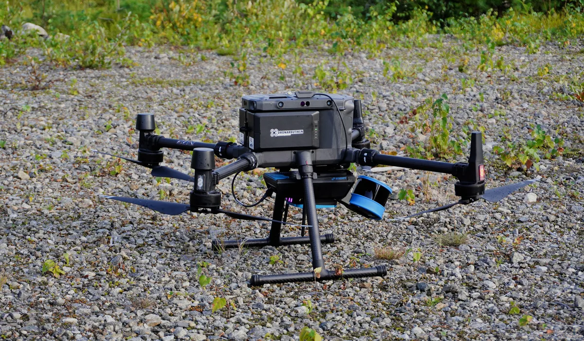
Featured photo of a surveying drone with a LiDAR sensor by Jonte via Wikimedia Commons, licence CC BY SA 4.0, cropped.