A land surveyor is a specialist who measures land and the features on it, including ground levels, boundaries, buildings, trees, drainage and buried services, and turns those measurements into accurate drawings and data. Architects, engineers, developers, solicitors and homeowners rely on a land surveyor whenever a decision depends on knowing exactly what is on a site and where it is.
The hardest part for most people is not finding a surveyor but knowing which survey to ask for. This guide is built as a decision guide. It starts with your situation, points you to the right type of land surveying, explains what you should receive, sets out 2026 costs and finishes with the questions to ask before you book. It is written for clients in Liverpool, Merseyside and the North West.
In this guide
- What a land surveyor does
- Land surveyor, building surveyor or engineer
- Which land survey you need
- Topographical surveys
- Boundary surveys and Land Registry plans
- Measured building surveys
- Utility surveys and PAS 128
- Drones and laser scanning
- Land surveyor costs in 2026
- How to brief a land surveyor
- Plain English glossary
- How to choose a land surveyor
- Land surveying in the North West
- FAQs
What a Land Surveyor Does
A good surveyor collects precise measurements on site and presents them in a form other professionals can design from. The work covers three broad areas.
- Measuring the ground, including levels, slopes, contours and the position of features such as walls, fences, trees, kerbs and drainage covers.
- Measuring buildings, including floor plans, elevations, sections and roof levels of existing structures.
- Locating what is hidden, including buried pipes and cables, and the true position of boundaries compared with title plans.
Modern land surveying uses robotic total stations, satellite positioning, laser scanners and drones. The output is usually a digital drawing that architects and engineers can open directly in their design software, tied to the national grid and to a recognised height datum.
This type of surveyor does not judge the condition of a building or design its structure. That is the job of a building surveyor or a structural engineer, which is why it pays to be clear about which professional you need before you book.
Land Surveyor, Building Surveyor or Structural Engineer
These three roles are often confused, and the wrong choice wastes time and money. The table below shows the difference.
| Land surveyor | Building surveyor | Structural engineer | |
|---|---|---|---|
| Main question | What is on the site and exactly where is it | What condition is the building in | Is the structure strong and stable enough |
| Typical output | Topographical, boundary or measured drawings | Condition report, defects advice, schedules | Calculations, structural drawings, reports |
| Typical client | Architects, developers, solicitors, homeowners | Buyers, landlords, tenants, owners | Builders, homeowners, building control |
| Professional body | RICS geomatics, Geospatial Survey Association, CICES | RICS building surveying | IStructE, ICE |
On many projects you need more than one. An extension, for example, might need a geomatics surveyor for the site levels, a building surveyor for the condition of the existing house and a structural engineer for the new beams and foundations.
Which Land Survey Do You Need
Start with what you are trying to do. The table below matches the most common situations to the right type of land surveying.
| Your situation | Survey you need | What you receive |
|---|---|---|
| Planning a new house, extension or development on a plot | Topographical survey | A levelled plan of the site with features, contours and spot levels |
| Arguing with a neighbour about where the fence should be | Boundary survey | A measured plan comparing physical features with the title plan |
| Applying to fix an exact boundary with HM Land Registry | Determined boundary survey | A certified plan meeting Land Registry accuracy rules |
| Refurbishing, extending or leasing an existing building | Measured building survey | Floor plans, elevations and sections of the building |
| Digging foundations, drains or service trenches | Utility survey | A plan of buried pipes and cables graded to PAS 128 |
| Surveying a large, steep or hard to reach site | Drone or laser scan survey | A point cloud, 3D model and drawings created from it |
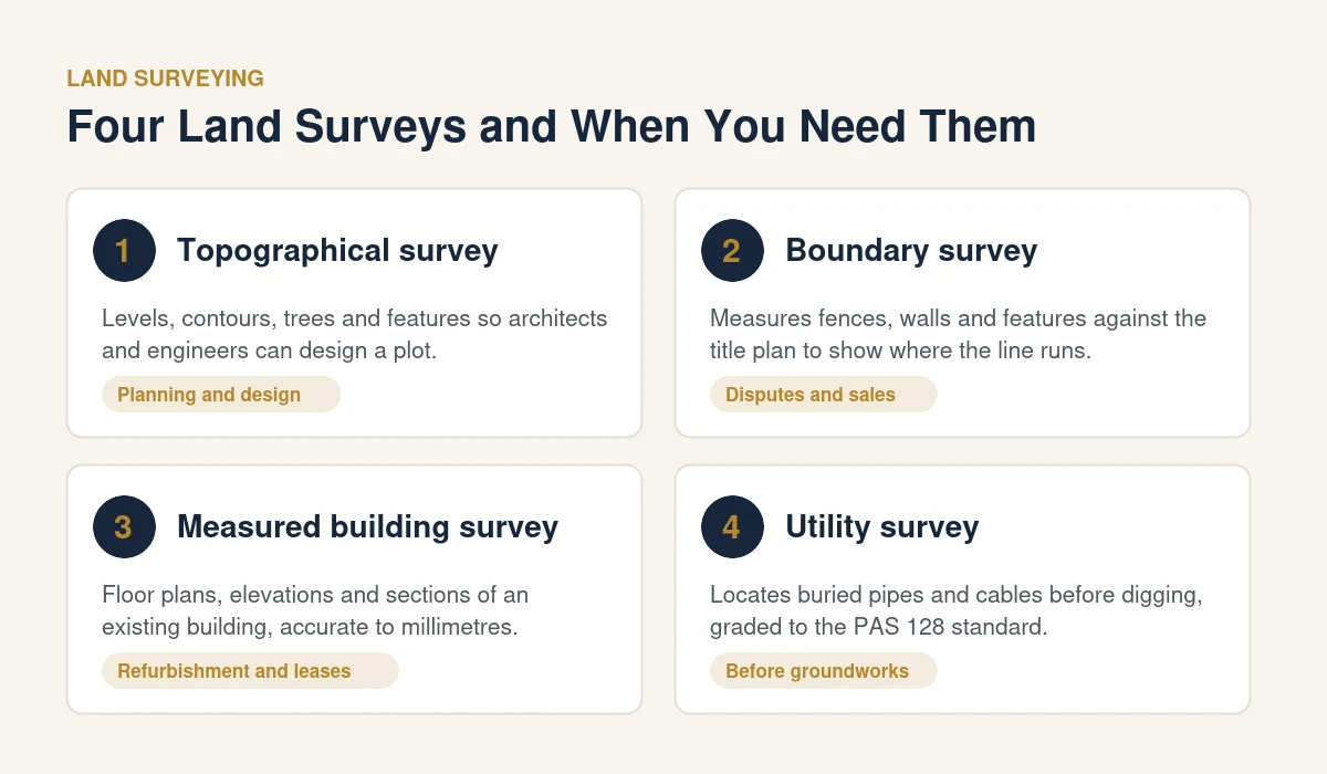
If your situation covers more than one row, tell the land surveyor at the start. Combining surveys in one visit is usually cheaper than booking them separately.
Topographical Surveys
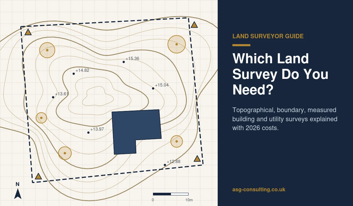
A topographical survey is the most common job a land surveyor carries out. It records the shape of the ground and everything on it, so that designers can work from facts rather than guesses. A typical topographical survey shows the following.
- Spot levels and contours across the site.
- Buildings, walls, fences, gates and hard surfaces.
- Trees, with their position, trunk size and canopy spread.
- Kerbs, steps, ramps and changes in level.
- Manhole covers, gullies and visible drainage, often with cover and invert levels.
- Overhead cables, street furniture and other visible services.
- The site boundary features, as found on the ground.
Levels are normally tied to Ordnance Datum Newlyn, the national height system, and positions to the Ordnance Survey national grid. That means the drawing lines up with other mapping and with future surveys. Architects use topographical surveys to set floor levels and drainage falls, while engineers use them to design foundations, retaining walls and access roads.
Boundary Surveys and Land Registry Plans
Many people are surprised to learn that a Land Registry title plan does not show the exact legal boundary. Under the general boundaries rule, the red line on a title plan shows the general position of the boundary only. It is drawn on Ordnance Survey mapping and is not precise enough to settle where a fence should stand to the nearest few centimetres.
A boundary survey by a land surveyor measures the physical features on the ground, such as walls, fences and hedges, and compares them with the title plans, old deeds and historic mapping. The result is an evidence based opinion on where the boundary is likely to run, which is often enough to help neighbours reach agreement.
Where owners want the boundary fixed precisely, they can apply to HM Land Registry for a determined boundary. The Land Registry practice guide on determined boundaries requires a plan accurate to plus or minus 10mm, drawn to a stated scale no smaller than 1 to 200, and normally endorsed with a certificate from a chartered land surveyor or other suitably qualified professional. Our guide to lease plans and Land Registry plans explains the related rules for leasehold property.
Measured Building Surveys
A measured building survey records an existing building rather than open land. It produces floor plans, elevations, sections and sometimes roof plans, measured accurately enough for architects to design alterations and for agents to calculate floor areas for leases and sales.
Land surveying and measured building work often go together. A refurbishment project may need a topographical survey of the plot and a measured survey of the building, both tied to the same grid so the drawings fit together perfectly. Our guide to what a measured building survey involves covers this in more detail.
Utility Surveys and PAS 128
Hitting a gas main or a high voltage cable while digging is dangerous and expensive. A utility survey finds buried services before work starts. In the UK, utility surveys are commonly specified to PAS 128, the British Standards Institution specification for underground utility detection, verification and location.
PAS 128 grades the confidence of each result using quality levels.
- Quality level D is a desktop search of utility records only.
- Quality level C adds a site visit to match visible features such as covers and valves to the records.
- Quality level B uses detection equipment such as ground penetrating radar and electromagnetic locators to trace services.
- Quality level A verifies services by exposing them, for example with trial holes.
Ask the surveyor which quality level they will deliver. A cheap survey that only reaches level D is not a substitute for detection on site before excavation.
Drones and Laser Scanning in Land Surveying
Technology has changed land surveying more in the last ten years than in the fifty before. Drones capture thousands of overlapping photographs that software turns into accurate 3D models and orthophotos, which is ideal for large sites, roofs and areas that are unsafe to walk. Terrestrial laser scanners capture millions of points per minute, creating a point cloud of buildings and complex structures.
These methods do not replace traditional equipment. A good surveyor uses ground control points measured with a total station or satellite receiver to make sure drone and scan data sits in the right place. Our guide to drone survey costs in Merseyside explains when an aerial survey is the better value option.
Land Surveyor Costs in 2026
Fees depend on the size of the site, the amount of detail, access and how quickly you need the drawings. These are published UK ranges for 2026.
| Service | Typical 2026 cost |
|---|---|
| Topographical survey, small residential plot under a quarter of an acre | 500 to 1,200 pounds |
| Topographical survey, plot of a quarter of an acre to one acre | 900 to 2,000 pounds |
| Topographical survey, multi acre development site | 2,000 to 6,000 pounds or more |
| Measured building survey | 400 to 1,800 pounds |
| Utility detection survey | 500 to 1,500 pounds |
| Basic boundary determination | 500 to 1,200 pounds |
| Expert boundary report for a dispute | 1,200 to 3,000 pounds |
| Determined boundary plan for Land Registry | 2,000 to 5,000 pounds |
Figures are indicative ranges published by BestBuilders for the third quarter of 2026. The same source notes that prices in London and the South East sit at the upper end, while the North of England tends to sit towards the lower end. Always ask for a written quote that lists exactly what is included.
How to Brief a Land Surveyor
A clear brief gets you an accurate quote and a drawing that does what you need. Before you contact a land surveyor, gather the following.
- The address and a site plan, ideally with the area to be surveyed marked on it.
- The purpose of the survey, such as a planning application, a boundary question or a refurbishment.
- Who will use the drawings, for example your architect, engineer or solicitor, and the file format they want.
- The level of detail, including whether trees, drainage inverts, roof levels or internal floors are needed.
- Any access issues, such as locked gates, occupied buildings, livestock or dense vegetation.
- Your deadline, especially if a planning submission or completion date depends on it.
- Existing information, such as old surveys, title plans, deeds and utility records.
If you are not sure what level of detail you need, ask your architect or engineer to speak to the surveyor directly. A short conversation at the start avoids a second site visit later.
Plain English Glossary of Land Surveying Terms
Survey drawings come with their own language. These are the terms you are most likely to see.
- Total station, an instrument that measures angles and distances very precisely, often robotic so one person can operate it.
- GNSS, satellite positioning equipment used to fix control points to the national grid.
- Ordnance Datum Newlyn, the national height system for mainland Britain, based on mean sea level at Newlyn in Cornwall.
- National grid, the Ordnance Survey coordinate system used to position features on maps.
- Spot level, a single height measured at a point, shown as a number on the drawing.
- Contour, a line joining points of equal height, which shows the shape of the ground.
- Invert level, the level of the inside bottom of a drain or pipe, needed to design new drainage.
- Point cloud, millions of measured 3D points captured by a laser scanner or drone.
How to Choose a Land Surveyor
Land surveying is not a protected title, so check credentials before you book. Look for these signs of a reliable land surveyor.
- Professional membership, such as chartered membership of RICS in the geomatics pathway, or membership of the Chartered Institution of Civil Engineering Surveyors.
- Trade association membership, such as the Geospatial Survey Association, formerly The Survey Association, whose members work to agreed standards.
- Professional indemnity insurance that covers the value of decisions your project will make from the survey.
- Sample drawings from similar sites, so you can see the level of detail and presentation.
- A clear specification stating accuracy, coordinate system, height datum, deliverables and timescale.
Price matters, but the cheapest survey is often the one that misses a drain or a level, and those mistakes cost far more to put right during construction.
Land Surveying in Liverpool and the North West
Sites across Liverpool, Merseyside and the wider North West bring their own land surveying challenges.
- Sloping plots on the Wirral, in Woolton and around the edges of the city need detailed levels for retaining walls, drainage and accessible entrances.
- Former industrial and dock land often has buried structures, old services and made ground that need careful utility and topographical survey work.
- Tight terraced streets make access, parking and neighbour relations part of planning the survey.
- Old boundaries between Victorian terraces are often marked by walls rebuilt many times, which makes boundary surveys more complex.
- Former mining areas around St Helens and parts of the Wirral may need extra checks before development.
A land surveyor who works locally will already know the common site conditions, the planning expectations and the best way to work on busy streets.
Land Surveyor FAQs
How long does a land survey take?
Fieldwork for a small residential plot often takes less than a day. Drawings usually follow within one to two weeks, depending on the size of the site and how busy the land surveyor is.
Do I need a topographical survey for planning permission?
Not always, but many councils and most architects expect one for new houses, extensions on sloping sites and any development where levels, trees or drainage matter.
Can a land surveyor settle a boundary dispute?
A land surveyor can provide strong evidence of where a boundary is likely to run, and many disputes settle once both sides see it. If agreement is not possible, the evidence can be used in a determined boundary application or in legal proceedings.
What file formats will I receive?
Most land surveying drawings are delivered as CAD files and PDFs. Laser scan and drone surveys can also include point clouds and 3D models. Confirm the format with your architect before you book.
Is a drone survey as accurate as a ground survey?
For many tasks it is accurate enough, especially when tied to ground control points. For precise building work, boundary plans and drainage levels, a ground survey or a combination of both is usually best.
Should I use a land surveyor before buying a plot?
Yes, if you plan to build on it. A topographical survey and a utility search before you commit can reveal steep levels, buried services, protected trees or boundary problems that change what you can build and what the plot is really worth. The fee is small compared with the cost of discovering these issues after purchase.
Land and Site Surveys in Liverpool
ASG Consulting is regulated by RICS. Our team provides topographical and site surveys, measured building surveys and drone surveys across Liverpool, Merseyside and the North West, with drawings tied to the national grid and ready for your design team. To discuss your site, visit our measured building survey page or our drone surveying service.
About the Author
Harry is a property content writer with 3 years of experience writing about building surveying, commercial property and property compliance in the UK. He writes the guides at ASG Consulting for buyers, tenants and landlords, turning survey practice into clear, practical advice.
Reviewed by Dave MacMillan MRICS, chartered surveyor at ASG Consulting. Dave checks the technical content of our guides against current RICS practice before they are published.