A boundary dispute surveyor is a chartered land surveyor who works out where the legal boundary between two properties really lies. They study the deeds, plans, maps and aerial photographs, measure the features on the ground and give an independent expert opinion that neighbours, mediators, HM Land Registry or a court can rely on. Bringing one in early is often the quickest and cheapest way to stop a boundary dispute from turning into years of stress and legal bills.
This guide is laid out as an escalation ladder. It starts with the simple steps every neighbour should try, shows what evidence decides where a boundary runs, explains when to call in a surveyor and what they produce, and then walks through mediation, boundary agreements, determined boundaries and court as a last resort. It is written for homeowners and landlords in Liverpool, Merseyside and the North West.
In this guide
- Why boundary disputes happen
- The general boundaries rule
- The escalation ladder
- First steps when a dispute starts
- Evidence that decides a boundary
- What a boundary dispute surveyor does
- Preparing for the survey
- Common scenarios
- Mediation
- Boundary agreements and determined boundaries
- Tribunal and court
- Buying or selling
- How to avoid a dispute
- Boundaries in Liverpool and Merseyside
- FAQs
Why Boundary Disputes Happen
Most boundary problems start with something small. A fence is replaced a little further over than the old one. A hedge is grubbed out and nobody remembers where it stood. An extension or driveway is built close to the edge of a plot. A new owner reads the title plan and assumes the red line is exact. Over time, small differences of a few centimetres can grow into a serious boundary dispute that affects access, parking, building plans and even the sale of a home.
RICS notes that boundary disputes are becoming more common in England and Wales, and that they can be costly, slow and damaging to relationships between neighbours. The earlier the facts are established, the easier they are to resolve.
The General Boundaries Rule
One of the biggest misunderstandings is the title plan. HM Land Registry title plans are based on large scale Ordnance Survey mapping and show only the general position of a boundary. The red line does not define the exact legal course of the boundary, and small changes or the type of physical feature, such as whether it is a fence, wall or hedge, may not show up at all.
This is known as the general boundaries rule. It means that a title plan alone rarely settles an argument over a strip of land a few metres wide or less. To work out the exact line, you usually need to go back to the original conveyance that first split the land, look at older plans and maps, and compare them with what is on the ground. Our guide to Land Registry plans explains more about how these plans are prepared.
The Boundary Dispute Escalation Ladder
The infographic below shows the usual route, starting with the cheapest and least stressful options at the bottom.
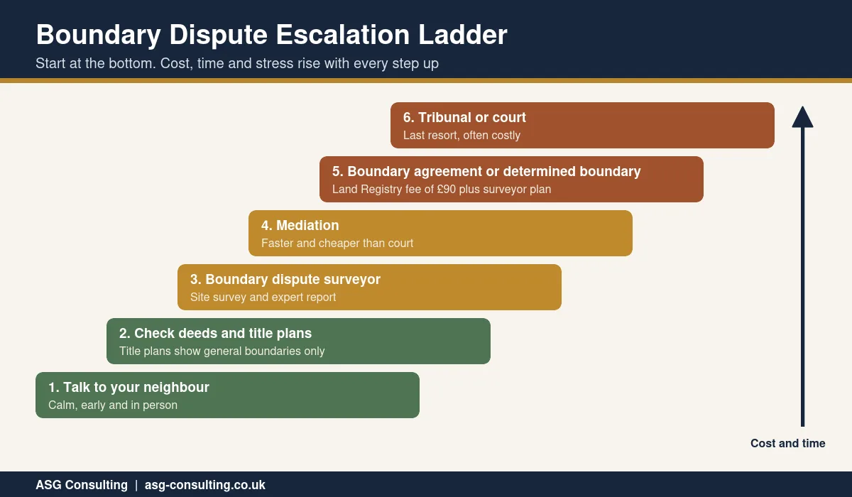
- Talk to your neighbour. Raise the issue early, calmly and in person, ideally before any new fence or wall goes up.
- Check the deeds and title plans. Gather your title register, title plan and any older deeds and conveyance plans.
- Instruct a boundary dispute surveyor. Get an independent expert report based on the documents and a measured survey.
- Try mediation. A trained mediator helps you reach a practical agreement without going to court.
- Record the outcome. Formalise it with a boundary agreement or a determined boundary at HM Land Registry.
- Tribunal or court. Only as a last resort, when every other step has failed.
Each step up the ladder usually costs more, takes longer and puts more strain on the relationship. Most disputes can and should be settled on the lower rungs.
First Steps When a Boundary Dispute Starts
What you do in the first few days often decides how the rest of a boundary dispute plays out. Try to follow these steps.
- Stay calm. Avoid arguments over the fence and do not remove or damage anything on the disputed line.
- Ask for a pause. If building or fencing work is under way, ask politely for it to stop until the line is agreed.
- Take photographs. Record the current position of fences, posts, walls and hedges, with dates.
- Get your documents. Download your title register and plan from HM Land Registry and find any older deeds.
- Put things in writing. Send a short, friendly note setting out your concern and suggesting a meeting.
- Take early advice. A short call with a surveyor can tell you whether the evidence supports your view before positions harden.
Evidence That Decides a Boundary
A boundary dispute is decided on evidence, not on who feels most strongly. The main sources are as follows.
- The original conveyance. The deed that first divided the land, and its plan, is usually the starting point.
- Title registers and plans. Useful for the general position and any notes, but not conclusive on the exact line.
- Historical maps. Older Ordnance Survey editions can show where fences, walls and hedges stood decades ago.
- Aerial photographs. These can show the position of features over time, especially where a fence has moved.
- Physical features. Old posts, wall foundations, hedge roots, ditches and changes in ground level all give clues.
- Measured survey data. An accurate survey of what is on the ground, tied to known reference points.
- Witness evidence. Statements from long standing neighbours or previous owners about where features used to be.
The Civil Justice Council boundary disputes guidance stresses that on site meetings are especially valuable, because pointing to features on the ground is often clearer than photographs or plans.
What a Boundary Dispute Surveyor Does
A boundary dispute surveyor brings the documents and the ground together. A typical instruction includes the following steps.
- Document review. Collecting and analysing deeds, title plans, historic maps and aerial images.
- Site inspection. Walking the boundary, recording every feature and taking photographs.
- Measured survey. Using a total station, GPS or similar equipment to map the site accurately. Our guide to land surveyors explains how this works.
- Analysis. Overlaying the deed plans on the measured survey and testing where the legal line most likely runs.
- Report and plan. A clear written opinion with plans showing the likely boundary and the evidence for it.
- Next steps. Help with negotiations, mediation, boundary agreements or, if needed, expert evidence for a tribunal or court.
RICS suggests asking any surveyor whether they follow the current RICS boundaries guidance, have mapping experience and have given expert evidence before. In a contested case, both sides may agree to appoint a single joint expert to keep costs down.
Preparing for the Survey
You can help your boundary dispute surveyor work faster, and keep fees down, by preparing in advance.
- Collect your title register, title plan and any older deeds or conveyance plans.
- Find old photographs that show fences, walls or hedges, ideally with dates.
- Note when features were changed and who did the work.
- Make a list of the specific points in dispute, such as one fence post or a strip along a driveway.
- Arrange access to both sides of the boundary if your neighbour agrees.
A focused instruction usually leads to a clearer report. If your neighbour is willing, appointing one boundary dispute surveyor jointly can be the fairest and cheapest option of all.
Common Boundary Dispute Scenarios
Every case is different, but these situations come up again and again.
| Situation | What usually helps |
|---|---|
| A new fence seems to have moved over | Compare old photographs and post positions, then agree the line before more work is done |
| An extension is planned near the edge of the plot | Get a measured survey and agree the boundary before applying for planning or starting work |
| A shared driveway or path is blocked | Check the deeds for rights of way as well as the boundary itself |
| A hedge or tree line has been removed | Use aerial photographs and historic maps to show where it stood |
| A sale is held up by a boundary query | A surveyor plan and a boundary agreement can reassure the buyer and lender |
Some problems that look like boundary issues are really about rights of way, party walls or building work next to a shared wall. Works to a shared wall usually fall under the Party Wall etc. Act 1996 instead, and our guide to a party wall schedule of condition explains how those cases are handled.
Mediation
Mediation is often the most effective way to settle a boundary dispute once both sides have the facts. A neutral mediator helps the neighbours negotiate a solution, often on site, and the outcome stays in the hands of the people involved rather than a judge. It is usually quicker, cheaper and less formal than litigation, and costs are known at the start.
RICS runs a Boundary Disputes Mediation Service, set up with the Property Litigation Association and supported by the Civil Justice Council. Courts also expect parties to have tried alternatives first, and a judge can pause a case to allow mediation. Having a boundary dispute surveyor report ready before mediation gives both sides a clear, independent starting point.
Boundary Agreements and Determined Boundaries
Once you and your neighbour agree where the boundary runs, it should be recorded so the question does not come back when either of you sells.
- Boundary agreement. A written agreement, with a plan prepared by a surveyor, that can be noted on the register at HM Land Registry.
- Determined boundary. A formal application to record the exact line of the boundary on the register, using form DB.
According to the government guidance on determined boundaries, the application fee is 90 pounds, plus surveyor and legal fees. You need evidence such as deeds or an expert report, and a plan that should be prepared by a chartered land surveyor. If your neighbour agrees, they sign the form and plan. If they object and the objection is valid, the matter can be referred to a tribunal. A determined boundary stays in place if either property is sold.
Tribunal and Court
If agreement is impossible, a boundary can be decided by a tribunal or the courts. This should be a last resort. The Civil Justice Council warns that boundary disputes can take years and become disproportionately expensive, sometimes far more than the value of the land involved. The usual rule is that the losing side pays the costs of the other side, but courts can limit what is recoverable, so even a winner may be left out of pocket.
If a case does reach this stage, the boundary dispute surveyor may give expert evidence. Their duty is to the court, not to the person who pays them, which is why an independent and well reasoned report from the start carries so much weight.
A Boundary Dispute When Buying or Selling
Sellers are asked about disputes with neighbours on the property information form, and an unresolved boundary dispute must be disclosed. Buyers, lenders and their solicitors may want it settled before they proceed, and some buyers will walk away. Resolving the issue, ideally with a surveyor plan and a recorded boundary agreement, is usually the best way to protect the value and saleability of your home.
If you are buying, compare the title plan with what you see on site, and ask about any fence that looks new or out of line. A full home buyers survey will note obvious boundary concerns so your solicitor can raise questions before exchange.
How to Avoid a Boundary Dispute
Many disputes can be prevented with a few simple steps.
- Compare the title plan with the property before you buy, and ask questions about any odd fence lines.
- Agree the line with your neighbour in writing before replacing a fence, wall or hedge.
- Keep photographs of boundary features before and after any work.
- Get a measured survey before planning an extension, new driveway or building near the edge of your land.
- Record any agreement with HM Land Registry so future owners are bound by it.
Boundaries in Liverpool and Merseyside
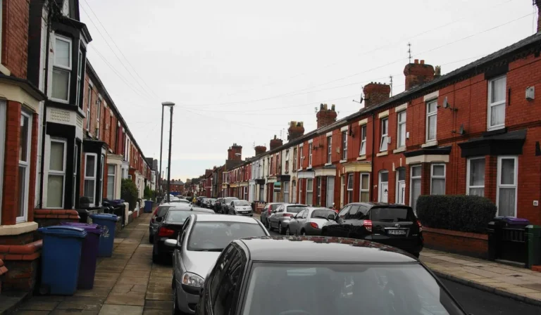
Boundary questions in Liverpool often come from the way the city grew. Victorian terraces with narrow back yards and shared alleyways, interwar semis with shared driveways, and post war estates where front gardens were later opened up for parking all create room for confusion. In older areas, original walls and fences have often been replaced several times, and the deeds may date back more than a century.
Across Merseyside, the Wirral and Cheshire, larger gardens, field edges, hedges and ditches bring their own challenges, especially where land was split for new houses. A local boundary dispute surveyor who understands these patterns, and the historic mapping of the area, can usually narrow the argument down quickly.
Boundary Dispute Surveyor FAQs
How much does a boundary dispute surveyor cost?
It depends on the size of the site, the amount of historic research and whether you need a measured survey, a report, mediation support or court evidence. Ask for a clear written quote that sets out each stage.
Is the Land Registry title plan accurate?
Title plans show the general position of a boundary, not its exact line. They are a useful guide but rarely settle a dispute about a narrow strip of land on their own.
Can I move a fence back to where I think the boundary is?
It is wise not to. Taking matters into your own hands can escalate the dispute and may expose you to a claim. Get the facts from a surveyor and try to agree the line first.
How long does a boundary dispute take to resolve?
Many are settled within weeks once the evidence is clear. Disputes that go to a tribunal or court can take months or years, which is why early advice and mediation are so valuable.
What is a determined boundary?
It is an exact boundary line recorded on the register at HM Land Registry, following an application on form DB with a surveyor plan and supporting evidence.
Do I need a solicitor as well as a surveyor?
For simple cases, a surveyor report and a neighbourly agreement may be enough. Where legal rights are disputed, or a formal agreement or court action is needed, a solicitor and a surveyor usually work together.
Can my neighbour build right up to the boundary?
They can usually build on their own land up to the boundary, subject to planning, Building Regulations and the Party Wall etc. Act 1996 where foundations or shared walls are involved. Agreeing the exact line before work starts avoids costly problems later.
Does a hedge or ditch change where the boundary is?
On rural and edge of town plots, there is a long standing legal presumption that where a hedge and ditch run together, the boundary lies on the far side of the ditch from the hedge. The deeds can override it, so a surveyor will check both before giving an opinion.
Boundary Advice in Liverpool
ASG Consulting is regulated by RICS. Our surveyors carry out measured and land surveys across Liverpool, Merseyside and the North West and can help you understand where your boundary lies before a disagreement grows. To discuss your boundary, visit our measured building survey page.
About the Author
Harry is a property content writer with 3 years of experience writing about building surveying, commercial property and property compliance in the UK. He writes the guides at ASG Consulting for buyers, tenants and landlords, turning survey practice into clear, practical advice.
Reviewed by Dave MacMillan MRICS, chartered surveyor at ASG Consulting. Dave checks the technical content of our guides against current RICS practice before they are published.
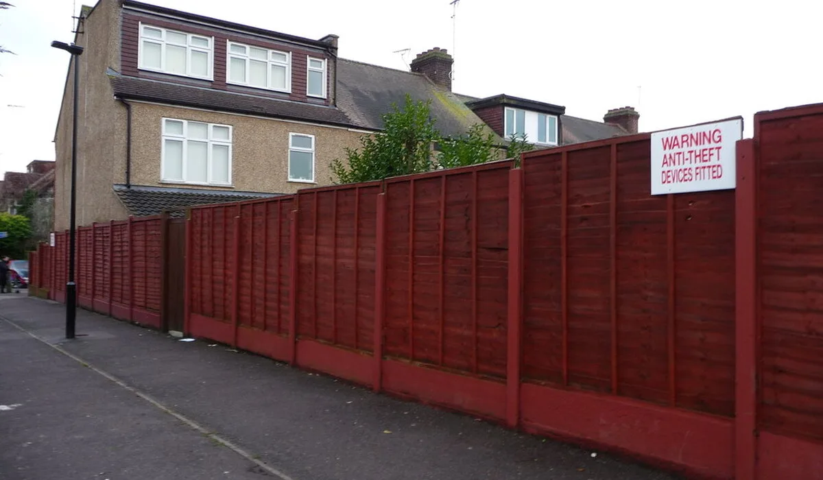
Featured photo of a back garden fence in Chingford by Christine Johnstone via Wikimedia Commons, licence CC BY SA 2.0, cropped.